Groundwater-Surface Water Interaction
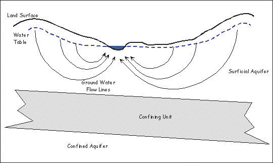
Figure 1.  The diagram to the left illustrates the typical relationship between groundwater and surface water. The surficial aquifer is recharged through rainfall on and infiltration into the upland areas between drainages. Discharges from the surficial aquifer occur into local streams and rivers. For estimates of recharge to and discharge from the groundwater system check out the following water budget diagram.
 The diagram to the left illustrates the typical relationship between groundwater and surface water. The surficial aquifer is recharged through rainfall on and infiltration into the upland areas between drainages. Discharges from the surficial aquifer occur into local streams and rivers. For estimates of recharge to and discharge from the groundwater system check out the following water budget diagram.
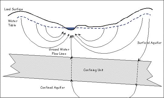
Figure 2. A very small percentage of rainfall infiltrates through the confining unit at the base of the surficial aquifer. Depending on the permeability of the confining unit and the pressure conditions in the confined aquifer, groundwater may move upward in a confined aquifer and discharge into the surficial aquifer and surface water drainage.
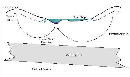
Figure 3. This diagram is typical of the relationship between groundwater and surface water during flood conditions. Notice that early stages of the flood allow surface water to discharge to the surficial aquifer in areas very near the river in the floodplain.
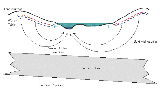
Figure 4. As the rainfall continues, the surficial aquifer is recharged and the water table rises. Eventually, surface water levels in the river and floodplain fall and the river stops discharging to shallow groundwater -- as shown in figure 1.
In the Piedmont or Mountains of North Carolina stream and river valleys are steeper and deeper. Rainfall infiltrates into the regolith and flows through the bedrock fractures. Although shallow groundwater flow is affected by the orientation of these fractures, it is still towards the rivers and streams as discharge from the groundwater system. The water budget diagram referred to earlier would still be appropriate (proportions would be similar) except that there would not be groundwater recharge to the confined aquifer system.
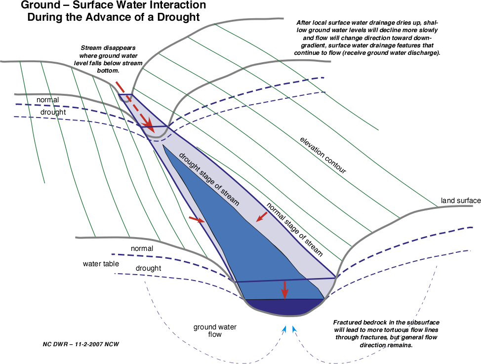
During advancing drought conditions ground - surface water interact as follows:
During advancing drought conditions ground - surface water interact as follows:
